
Archive Record
Images
Additional Images [17]
Metadata
Title |
Map of School District 65 |
Description |
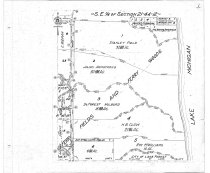
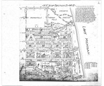
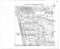
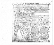
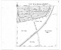
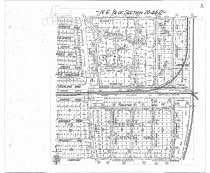
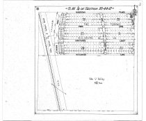
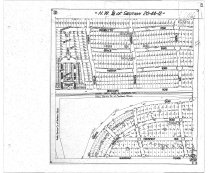
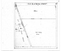
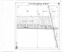
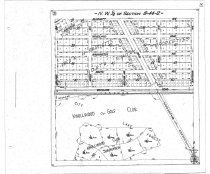
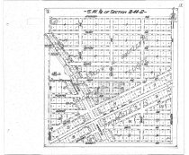
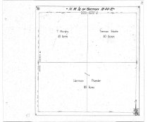
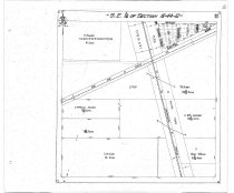
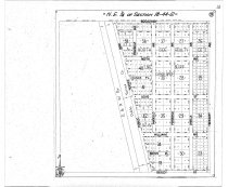
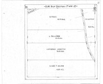
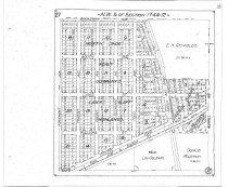
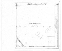
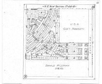
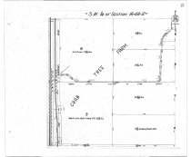
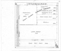
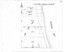
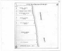
Map of School District 65 in Lake Bluff, IL. Set of maps of individual quarter sections prepared from tracings made for the Village of Lake Bluff in 1934 - shows landowners of larger properties 61.1 S.E.1/4 Section 21-44-12; 61.2 N.E. 1/4 Section 21-44-12; 61.3 S.W. 1/4 Section 21-44-12; 61.4 N.W. 1/4 of Section 21-44-12; 61.5 S.E. 1/4 of Section 20-44-12; 61.6 N.E. 1/4 of Section 20-44-12; 61.7 S.W. 1/4 of section 20-44-12; 61.8 N.W. 1/4 of Section 20-44-12; 61.9 S.E. 1/4 of Section 19-44-12; 61.10 N.E. 1/4 of Section 19-44-12; 61.11 N.W. 1/4 of Section 19-44-12; 61.12 S.W. 1/4 of Section 18-44-12; 61.13 N.W. 1/4 of Section 18-44-12; 61.14 S.E. 1/4 of Section 18-44-12; 61.15 N.E. 1/4 of Section 18-44-12; 61.16 S.W. 1/4 of Section 17-44-12; 61.17 N.W. 1/4 of Section 17-44-12; 61.18 S.E. 1/4 of section 17-44-12; 61.19 N.E. 1/4 of Section 17-44-12; 61.20 S.W. 1/4 of Section 16-44-12; 61.21 N.W. 1/4 of Section 16-44-12; 61.22 S.E. 1/4 of Section 16-44-12; 61.23 N.E. 1/4 of Section 16-44-12. There is no sheet 11. |
Caption |
Map 61-1 Maps of Quarter Sections in School District |
Date |
1934 |
Search Terms |
Map |
Collection |
Maps |
Object Name |
Map |
Object ID |
Map 61 |